PADDLING CLUBS
Map Regions My Trips How To Contribute Add Resource Add Trip Clubs Partners Get In Touch Search

Find your next paddling adventure!

Sorry no results found. Try expanding your search.

Region Details

Looking for the best places to Whitewater Kayak in and around New Denver? Below are some great routes, trips and resources to help you Whitewater Kayak in and around New Denver.

Click here to browse this area with our interactive map.

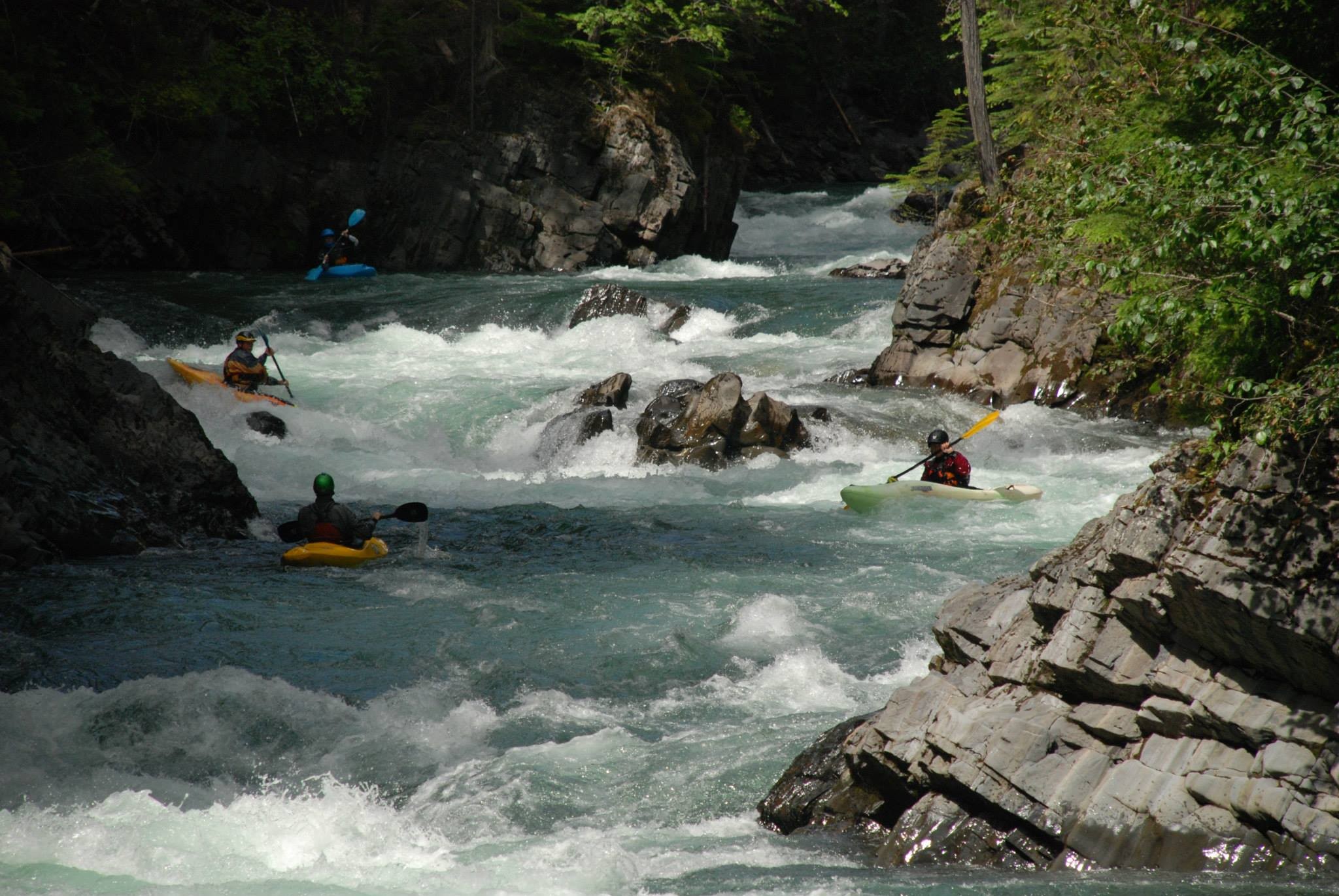
I think it was John Grace who once said "It's all just training for British Columbia". He was referring to the super challenging creeking and multi day wilderness whitewater trips that are located all over this mountainous province. There is a lifetime worth of easy and intermediate paddling too. Whether it is multi day ocean trips, winter whitewater paddling on Vancouver Island, surfing tidal rapids, creeking in the interior, remote trips up north BC offers it all and then some.

Whitewater Kayak Trips or Routes

New Denver

Wilson Creek 7km
Wilson Creek - The commonly used 7km put-in on Wilson wastes no time at all with all of it's class IV features found in the first 1.5km stretch. Starting from the put-in, expect to find several punchy read n' run ledge rapids amidst continuous boogie water, eventually leading up to a short and mildly busy "straight down the middle" canyon section that despite looking rather rowdy on approach, holds no real surprises. From 5.5km on, expect a much more relaxed affair (see Wilson 5.5km section description).
Wilson Creek 5.5km
Wilson Creek - A recently built put-in trail near km 5.5 on the Wilson Creek FSR now allows for class 3 paddlers the ability to start immediately after the more intimidating rapids upstream. Suitable for both creek and play boats, expect a scenic float with large eddy pools broken up by long, non-technical rapids with the occasional corner surprise amid lush forest scenery.
Wilson Creek 11km
Wilson Creek - The 11km put-in section starts with a nice long warm up leading into a much larger and much busier rapid that ends with a notorious river wide 2.5m high ledge that can only be run right of centre during optimal flows. Just downstream from this ledge is another large and somewhat technical, multi-tiered "S" drop that can either be partially portaged to avoid the entry move, or fully portaged when the exit hole looks rather meaty. After this feature expect nothing but low stress boogie water amidst some glorious canyon walls opening up to lush forest scenery till you reach the start of the 7km section (see Wilson 7km and 5.5km sections for more info).
Fitzstubbs Canyon
Fitzstubbs Creek - Fitzstubbs was long regarded as a "no go" zone for the reason of having several large and questionable waterfalls stacked within a remote canyon. Eventually, separate groups of curious paddlers found the levels and lines needed to put Fitzstubbs on the hucker's map. A tributary to Wilson Creek, Fitzstubbs can be run alone, or combined with Wilson Creek (entering just below the 11km put-in) making for a 20km journey. Ideal levels are generally based on when Wilson is running med or lower, but not too low.

Local Paddling Clubs

Canoe Kayak Freestyle Committee National Programs

Canoe Kayak Canada Freestyle is responsible for the growth and development of Freestyle Canoe/Kayak in Canada. We work with provincial, territorial and local organizations to hold programs that support athlete development. We also host National Team trials and support athletes at the international level.

123-555-1234


Stay Connected. Get the PaddlingMaps app today!
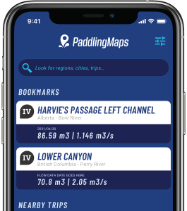