PADDLING CLUBS
Map Regions My Trips How To Contribute Add Resource Add Trip Clubs Partners Get In Touch Search

Find your next paddling adventure!

Sorry no results found. Try expanding your search.

Region Details

Looking for the best places to Whitewater Kayak in and around Galloway? Below are some great routes, trips and resources to help you Whitewater Kayak in and around Galloway.

Click here to browse this area with our interactive map.

I think it was John Grace who once said "It's all just training for British Columbia". He was referring to the super challenging creeking and multi day wilderness whitewater trips that are located all over this mountainous province. There is a lifetime worth of easy and intermediate paddling too. Whether it is multi day ocean trips, winter whitewater paddling on Vancouver Island, surfing tidal rapids, creeking in the interior, remote trips up north BC offers it all and then some.

Local Paddling Clubs

Canoe Kayak Freestyle Committee National Programs

Canoe Kayak Canada Freestyle is responsible for the growth and development of Freestyle Canoe/Kayak in Canada. We work with provincial, territorial and local organizations to hold programs that support athlete development. We also host National Team trials and support athletes at the international level.

Whitewater Kayak Trips or Routes around Galloway

Browse the Map
Lower Canyon
Bull River - This is a nice short section of river (3 km) that maintains its excitement fairly consistently throughout its length. It's short enough that a couple of runs are very do-able, and actually probably necessary to make the drive worthwhile. The run may be extended by driving an extra 7.5 km upstream of the bridge put-in. This adds a section of grade II+ paddling in a very scenic river valley. The run from the 3 km put-in starts out pretty low key, class II- for the first kilometer. A class II+/III- rapid just before a bend to the left starts the action off. Starting under the bridge, expect fairly continuous class III for about 1 kilometer. At this point, the river bends slightly to the left at an outcrop, which is the beginning of the canyon. The entire canyon (300 m) can be scouted on river left. After the last rapid of the canyon, the water is calm and moving slowly; the take-out is after a rock outcrop on river left. The carry up is a bit of a leg workout.

Photos of Galloway Trips

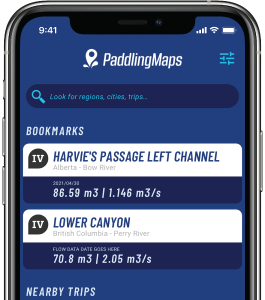
Stay Connected. Get the PaddlingMaps app today!