PADDLING CLUBS
Map Regions My Trips How To Contribute Add Resource Add Trip Clubs Partners Get In Touch Search

Find your next paddling adventure!

Sorry no results found. Try expanding your search.

Region Details

Looking for the best places to Whitewater Kayak in and around Bamfield? Below are some great routes, trips and resources to help you Whitewater Kayak in and around Bamfield.

Click here to browse this area with our interactive map.

I think it was John Grace who once said "It's all just training for British Columbia". He was referring to the super challenging creeking and multi day wilderness whitewater trips that are located all over this mountainous province. There is a lifetime worth of easy and intermediate paddling too. Whether it is multi day ocean trips, winter whitewater paddling on Vancouver Island, surfing tidal rapids, creeking in the interior, remote trips up north BC offers it all and then some.

Local Paddling Clubs

Canoe Kayak Freestyle Committee National Programs

Canoe Kayak Canada Freestyle is responsible for the growth and development of Freestyle Canoe/Kayak in Canada. We work with provincial, territorial and local organizations to hold programs that support athlete development. We also host National Team trials and support athletes at the international level.
Whitewater Kayak Trips or Routes around Bamfield

Browse the Map
Waterfalls Section
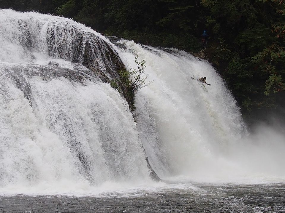
Sarita River - People say this is Vancouver Island’s answer to the Rio Del Rey. I haven’t paddled in Mexico, so I can’t say for sure, but the Sarita is a spectacular series of waterfalls in a stunning temperate rainforest surrounding. It starts with a fairly straightforward slide you can run centre right to left. Around the corner from this is about a 40 foot waterfall. In my experience you can either run down the middle or far left under the overhanging cedar tree. There may be other lines I haven’t seen. Scout from the left bank to pick your line. There seems like a bit of a cave on the left wall, but haven’t heard of anyone going in there. If you choose to portage you'll have to lower your boat down the left canyon wall. Portaging takes a while. Further down is a 15 foot slide/fall you can scout from the right bank and run left or middle. The final drop is said to be a 60 footer, but it looked like 50 to me. Scout from the left bank and get out early. Paddling between the two humps on the centre left works. There's a portage on the left as well. 60 cms on the Environment Canada online gauge is a nice medium/low. It would probably go higher. Not sure what the upper limit is. Sarita comes in with lots of rain and drops quickly.

Stay Connected. Get the PaddlingMaps app today!