PADDLING CLUBS
Map Regions My Trips How To Contribute Add Resource Add Trip Clubs Partners Get In Touch Search

Find your next paddling adventure!

Sorry no results found. Try expanding your search.

Region Details

Looking for the best places to Rec Kayak in and around Drayton Valley? Below are some great routes, trips and resources to help you Rec Kayak in and around Drayton Valley.

Click here to browse this area with our interactive map.

Diverse is how we would best describe the paddling in this mountain/prairie province. In the west of the province runs are characterized by beautiful backdrops, continuous rivers and cold water. Everything from mellow multi day floats in national parks to hairy class V creeking is available in the west. As you move further east the gradient drops but there are still plentiful paddling options for those looking to float mellow rivers in really unique surroundings. It is a huge province so don't neglect to look north and south too. A very worthwhile paddling destination in it's own right.

Area Sponsor

Local Paddling Clubs

Paddle Junkies

whitewater kayaking club focused on bridging the gap for adult beginner, novice and intermediate kayaking in Calgary and surrounding area
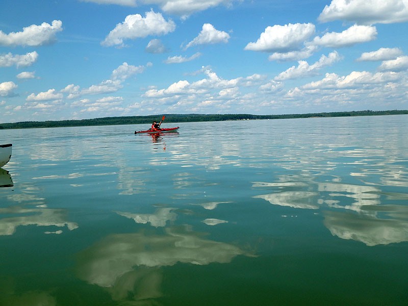
Rec Kayak Trips or Routes around Drayton Valley

Browse the Map
Brazeau Res. Campground Boat Launch
Brazeau Reservoir - Boat launch by the campground near the dam has restroom facilities
West Canal Campground and Day Use Area
West Canal Brazeau Reservoir - Located in the Brazeau Reservoir PRA the 'Canal' portion of the west canal offers great shelter on windy days and is easily accessed by turning left onto the gravel road, just after the Brazeau Reservoir bridge (AB-620W from Lodgepole), you’ll find access immediately on your right. This portion can be open as early as February and as late as November. Unlike the main body of water. To access the main body of water you can either paddle east from the canal for about 3 KM, where you’ll find a nice, sheltered bay to explore before the water starts to open. Alternatively, drive 4 km along the gravel road and put in at the West Canal Campground and Day Use Area, then head across to the south shore (this offers the best scenery and adventure). Following the south bank in an easterly direction will take you to the flooded forests. Here you’ll find plenty of birdlife, navigable reed beds, secluded bays (with some shore access for breaks), and wide-open water (that can be challenging if the wind picks up). Eventually you will end up at the Powerhouse at the east end where you will then start your journey back, or you can camp on Crown Land if you want to make the trip an overnight adventure.

Stay Connected. Get the PaddlingMaps app today!