PADDLING CLUBS
Map Regions My Trips How To Contribute Add Resource Add Trip Clubs Partners Get In Touch Search

Find your next paddling adventure!

Sorry no results found. Try expanding your search.

Region Details

Looking for the best places to Raft in and around Grande Cache? Below are some great routes, trips and resources to help you Raft in and around Grande Cache.

Click here to browse this area with our interactive map.

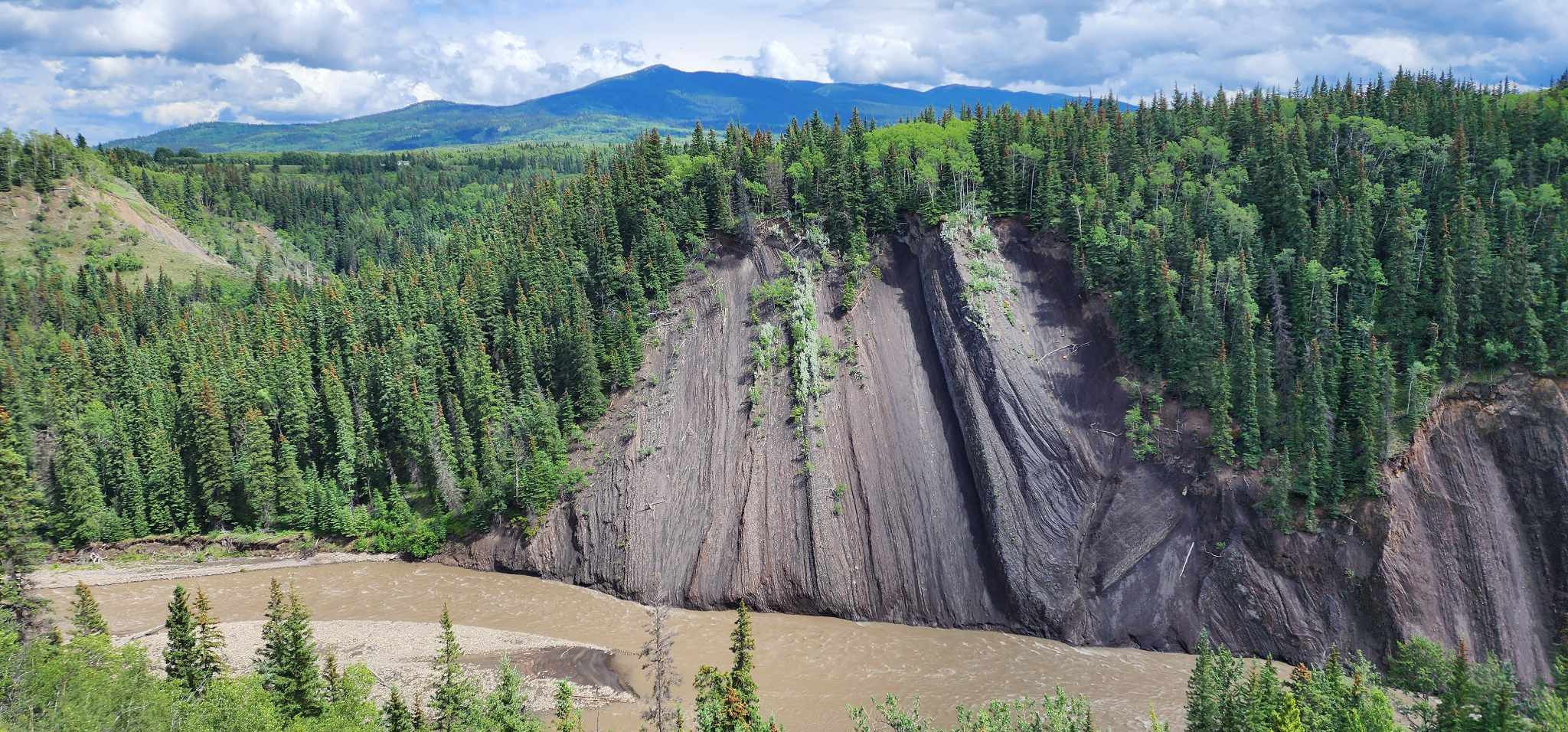
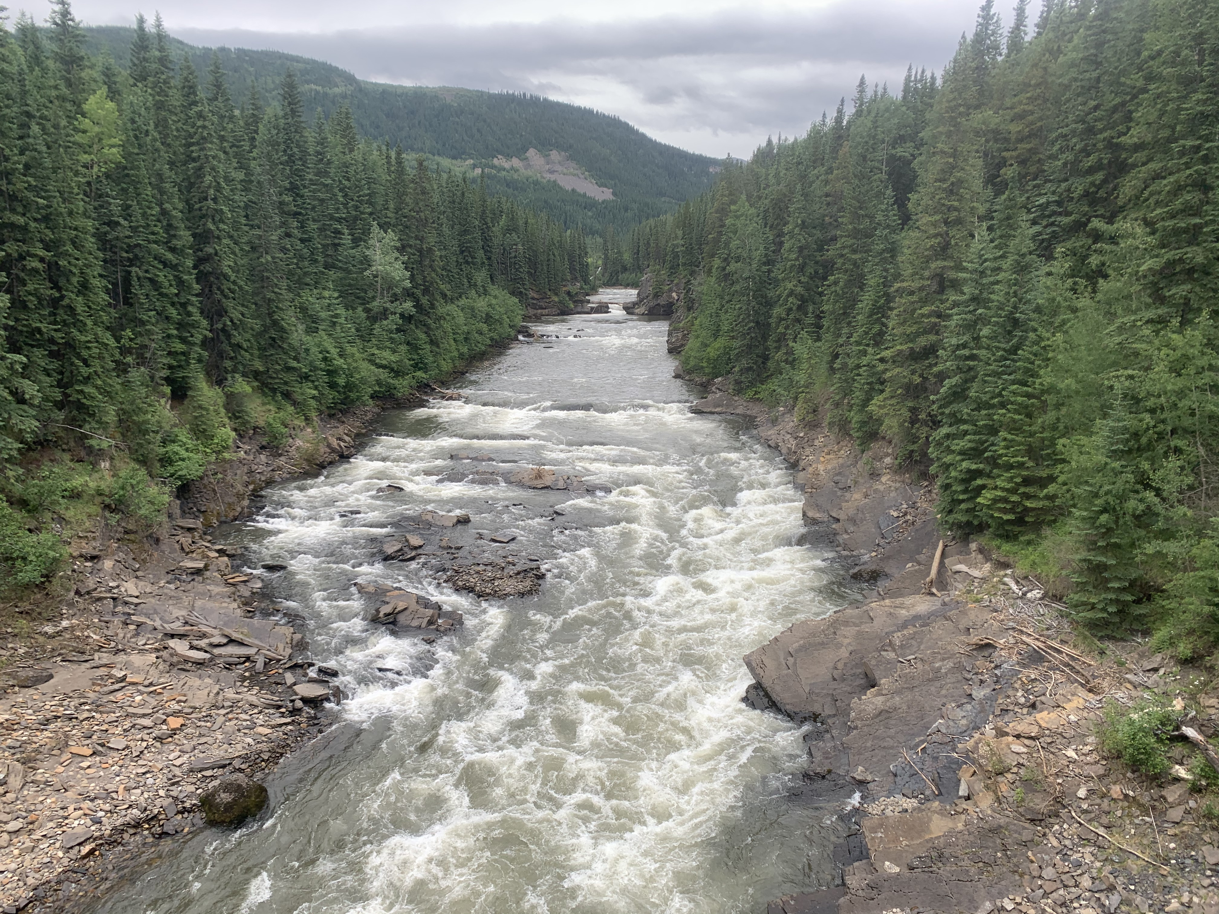
Diverse is how we would best describe the paddling in this mountain/prairie province. In the west of the province runs are characterized by beautiful backdrops, continuous rivers and cold water. Everything from mellow multi day floats in national parks to hairy class V creeking is available in the west. As you move further east the gradient drops but there are still plentiful paddling options for those looking to float mellow rivers in really unique surroundings. It is a huge province so don't neglect to look north and south too. A very worthwhile paddling destination in it's own right.

Area Sponsor

Aquabatics Calgary

Raft Trips or Routes

Grande Cache

Raft Run
Sulphur River - A very continuous grade II-III run through a deep scenic canyon. The canyon cuts through a coal seam and the grain of the rock provides endless eddies with clean sharp eddy lines, and lots of one-shot waves, particularly at high water. There are also a couple of decent sized, sticky hydraulics, especially at higher water. The run passes by the incredible Sulphur Gates before its confluence with the Smoky River. To get to the Sulphur Gates take out: you must ferry as soon as the Sulphur and Smoky rivers meet in order catch the river left eddy on the Smoky, located immediately downstream of Sulphur Gates. To get to the blue bridge take out: carry on down the mellow grade I-II Smoky for close to 1hr and grab the river right eddy after the blue bridge.
Main
Sulphur River - Renowned for its breathtaking beauty and steep canyons the Sulphur is a class II River with a little class III towards the end however, in flood this run turns into continuous class III and IV with many nasty hydraulics. The Sulphur merges with the Smoky River at the Sulphur gates. From this point on it is a relatively flat-water paddle through the scenic Smoky River valley to the take-out. The put in is incredibly beautiful but steep. Budget 2-4 hours on the water. Trip Info thanks to Wapiti Paddling Club. Original author unknown
Upper
Muskeg River - An easy flowing section with distinct eddies and straight forward river running as is a great section to take beginners down. There is the odd sweeper and/or strainer on this section to watch for. A quick paddle, easily completed in under 1 hour (but can be made longer with more surfs).
Middle
Muskeg River - See "Upper Muskeg" for the paddle to Mason Creek. Below Mason Creek, the gradient increases, and features become more pronounced. Intermediate paddlers will find this section challenging, especially when it comes to the 15' seal launch around Little Muskeg Falls. Rapid Description Fraser's Ledge is the first class III+ -IV drop below Mason Creek where the river funnels and deflects river right through a broken 5' ledge drop. This drop should be scouted, as the landing is full of rocks and sketchy at best. Scout and portage on river right. Tumble Weed is a small hole / wave feature downstream of Fraser's Ledge which gets a lot of play time. This spot is great for practicing freestyle wave moves on the river left side, and hole moves on the river right of the feature. Groups will spend a lot of time here, and it makes for a great spot for a break before heading down to Little Muskeg Falls. Little Muskeg Falls is a two stage class IV+ -V drop which drops into flat recirculating holes. You will be able to identify it ahead when the river constricts significantly. The drop has been run in the past, but it is wise to portage on the river left side. The portage is sketchy in wet weather, as the sloping rock leading to the seal launch becomes very slippery. There have been incidents in the past where people have lost their footing here, and have fallen into the class IV below. Wapiti Whitewater Kayakers has identified this spot as being extremely hazardous, and has launched some funding with the Alberta Whitewater Association to place a fixed bolt cable handrail for paddlers to use to help with the portage to the seal launch. The seal launch is about 15 feet off of an overhang landing in the large pool below. The take out is downstream a short ways just past a small class II. There is a calm stretch of river and the main falls can be heard here. Take out anywhere along the left short, and make your way back to the take out via a very steep 1.5km trail.

Resources

UBar Ranch Grand Cache

780-827-0604

grand cache

https://www.ubartrailrides.com/rentals/canoe-rentals/

Local Paddling Clubs

Paddle Junkies

whitewater kayaking club focused on bridging the gap for adult beginner, novice and intermediate kayaking in Calgary and surrounding area


Stay Connected. Get the PaddlingMaps app today!
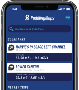