PADDLING CLUBS
Map Regions My Trips How To Contribute Add Resources Add Trips Clubs Events Partners Get In Touch Search

Find your next paddling adventure!

Sorry no results found. Try expanding your search.

Region Details

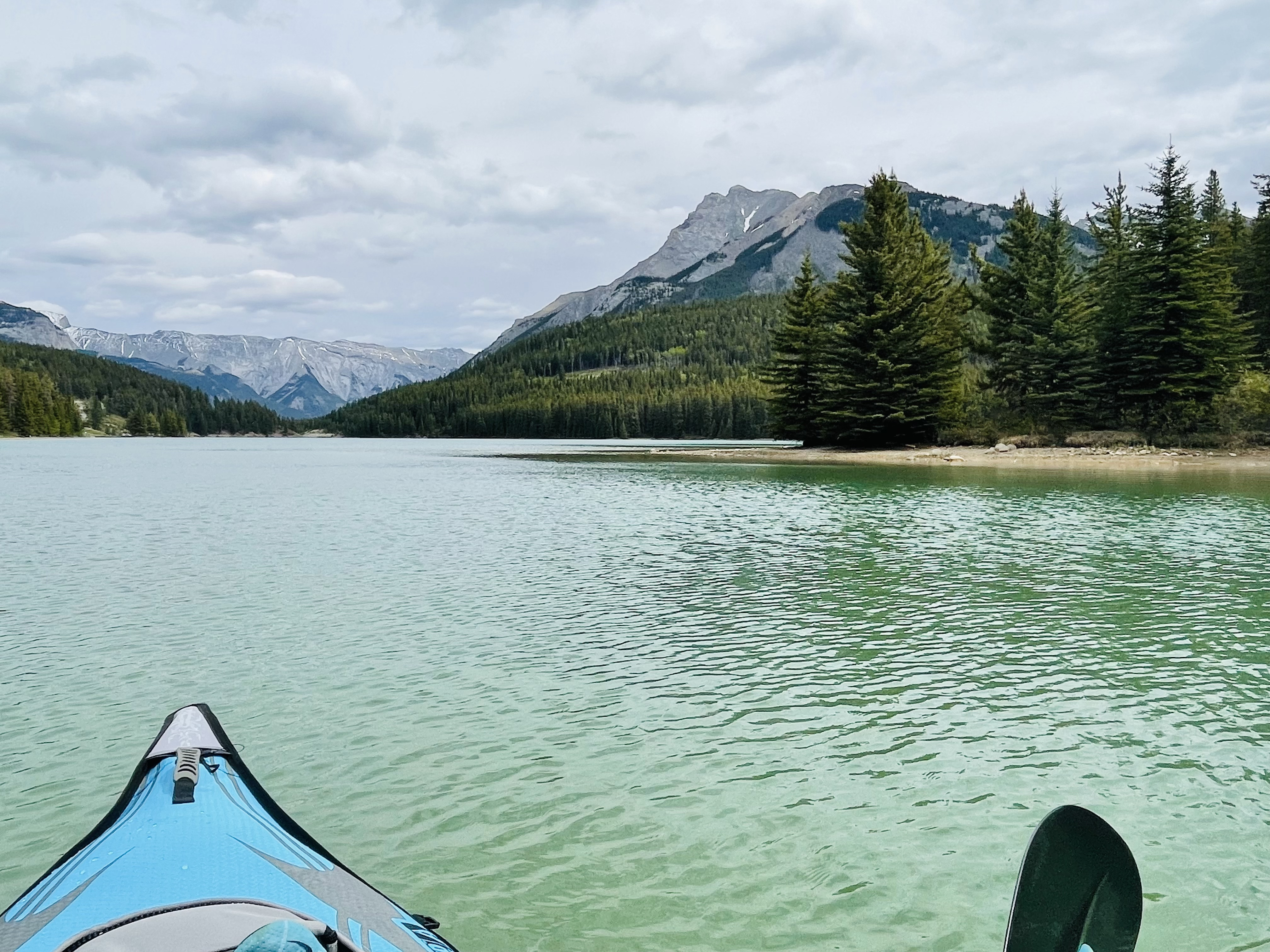
Looking for the best places to Raft in and around Banff? Below are some great routes, trips and resources to help you Raft in and around Banff.

Click here to browse this area with our interactive map.

Diverse is how we would best describe the paddling in this mountain/prairie province. In the west of the province runs are characterized by beautiful backdrops, continuous rivers and cold water. Everything from mellow multi day floats in national parks to hairy class V creeking is available in the west. As you move further east the gradient drops but there are still plentiful paddling options for those looking to float mellow rivers in really unique surroundings. It is a huge province so don't neglect to look north and south too. A very worthwhile paddling destination in it's own right.

Area Sponsor

Local Paddling Clubs

Paddle Junkies

whitewater kayaking club focused on bridging the gap for adult beginner, novice and intermediate kayaking in Calgary and surrounding area
Raft Trips or Routes around Banff

Browse the Map
Banff to Canmore
Bow River - A medium to large volume run in a very scenic valley. The paddling isn't overly difficult but paddlers should be able to maneuver confidently on Class I moving water before doing this run. The reason being there are often strainers and awkward corners to avoid. There are 3 locations where trips typically encounter challenges. The first is a sharp right turn below the hoodoo's in Banff. Keep an eye out for wood in the river before the corner, as the current is slowly eroding the bank and will push paddlers towards the wood. The second is to make sure paddlers take the right channel after the golf course. there is a split in the river, river left is blocked by wood. There is a large sign indicating the safe route to the right. The third is the area just before the park gates. The river becomes braided with some channels choked off with wood. Keep an eye out to find the right channel to follow. This trip is a fun full day run. If you'd like to shorten it down for an evening or half day run, you can pull out at the end of the golf course.
Castle Junction to Banff
Bow River - A medium volume run, with some fun Class II rapids along the way. Lots of meandering paddling, semi-regular strainers and world class scenery.
Lake Louise to Banff
Bow River - This is an overnight trip starting less approximately 1km west of the Lake Louise Park & Ride lot and end at the Banff Canoe Club in Banff. This trip is approximately 56km and took us 10 hours to do in mid-July. There is a back-country campground right on the Bow River called (BoC1). You must call the Banff backcountry office to book it. The campsite is approximately 6km (45-60 min) past Castle Junction. It is on the left side of the river and should be obvious to anyone. Basically, you can't miss it. There are various hazards on the river, including trees, rocks, sweepers, and moderate class two rapids, at various points throughout the trip. The most technically challenging part of the trip is the first day from the put-in spot to the Red Earth Creek rapids. The water is faster moving, the river is narrower, and there are generally more rapids. Our group had two paddle boarders and one canoe. Both didn't have too much difficultly with the rapids. Budget 4 hours for day 1 (Lake Louise to BoC1 campground) and 5-6 hours for day 2 finishing in Banff. Expect more paddling on day 2 as the flow rate isn't as fast after Red Earth Creek.
Paddle to the Fairmont
Spray River - This is a great beginner trip that is only good for 1-2 weeks of the year when the Spray comes up enough. Park at Bow Falls and walk up 5km along a very easy trail with occasional glances of the river. There is a big meadow where you can start. Close to a bridge across the river and the Spray backcountry campground. The first 200m is a swift channel. Beginners may prefer to walk it and start after the channel. Carry on to Bow Falls or all the way to Canmore. Good to go when flow is above 4cms. If you are really solid, carry on upstream to where Goat Creek and Spray River come together. This section will be burly grade 3 creeking though.
Fun in the sun
Simpson River - This is a great day trip in the spring. There's about 8km of river that is paddleable on the Simpson before it meets the Vermillion (which runs into the much better known Kootenay). There's a hiking trail that goes up the river valley. The trail will get to a point where there's an obvious canyon that has a few bends and is choked with wood. We started just below this canyon but I have seen other blogs starting higher up for multiday trips. It doesn't seem worth it and this is likely the best stretch with the least wood. There are no big rapids but it is continuous, shallow, and woody. You'll need good reactions and be prepared to avoid woody surprises. I would not recommend for non-grade 3 paddlers due to the wood potential. If you're in the area for a while, combine with some of the Vermillion of Kootenay. It won't be possible to run this until Kootenay allows watersports again. Park at the Simpson River Trailhead. You can take out at the confluence of the Simpson/Vermillion and walk a short ways back on the highway shoulder to your car.
Cascade Mountain Circumnavigation
Cascade River - This is a great weekend spring trip. You don't need high water levels for this to go but if you do paddle at lower flows expect to walk a couple rapids in the typical Cascade Whitewater run. If you don't paddle the big rapid right before Stewart Canyon, you're either going to have a heinous descent to the Canyon or just walk to the Minnewanka parking lot from there. Start at the Norquay parking lot. Hike to the Cascade River via Elk Lake to CR15. We camped at CR 15 and then paddled from CR 15 down to Stewart Canyon. There were a few log jams so you might be better to just hike a few kms downriver to get to the point where the river ceases to braid. The section above the classic whitewater section is really nice grade 2. The classic whitewater section is grade 3. You may be able to start higher up on the Cascade but there are two significant confluences by CR 15. It may be too shallow and woody upstream but a cool trip could be going up 40 mile creek and extending the trip. You could walk out from CR 6 but that seems like a very heavy hike for not much paddling. Thus, I'd only recommend this for strong grade 3 paddlers. If the pipestone is above 10, this should go. Thanks to Filip Wolanski for doing this trip with me.
Panther River Packraft Trip
Panther River - This is a fantastic packraft trip. I did it at what would be considered low flows for the Panther/Red Deer basin and it was awesome and pretty continuous. My friends who did this at higher flows (normal spring levels) said that things were washed out so I think this trip is actually better at low flows. Expect about half of the Red Deer gauge below the confluence to come from the Panther system. We saw bison, wolves and lots of other wildlife! Good luck. Start at the trailhead to the Cascade River fire road. Head up past CR6 and 15 and then head up the fire road heading north to the Panther Basin. Shortly after the Cascade Valley you can random camp with a Parks Permit. Make sure you're out of the range though. You'll pass through some beautiful lakes which would be worth bringing fishing equipment for if you had the time. The views from the fire road are better than expected! It took 1.5 days to walk to our putin, which is the ranger cabin next to Snow Creek, Wigmore Creek and the panther. There is a waterfall upstream you may want to go check out. I know folks who started upstream in the real headwaters but it was a fair bit of packing up and portages which may not be worth. The confluence of the two creeks and the Panther keeps the walk as short as possible and ensures you'll have water in the river. Going down at low flows will be great continuous grade 2 and 3 rapids with wood hazard. Keep your eyes out and be diligent. There's lots of great places to camp. The horse trail on the side of the Panther doesn't look great. I wouldn't want to be in a situation where I had to walk out on it! It's pretty continuous. I wouldn't want to do this trip without strong paddlers. Take out can be anywhere where the forestry road meets the Panther outside of the park but the blue bridge on the Red Deer might be the best option. I would combine this with going down the full Red Deer to Cartier Creek Campground to get more out of your shuttle time. This trip took 3 days but we like walking and paddling. If you want a more chill time you can easily make this a 5-6 day trip especially if you go down the classic hardboat Red Deer runs.

Stay Connected. Get the PaddlingMaps app today!